39.9767236
20.9234765
axiotheata
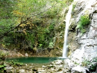
The waterfalls in Iliochori, Iliohori, Κεντρικό Ζαγόρι, Βλαχοχώρια,.
80 Ελλάδα, Iliohori, , Κεντρικό Ζαγόρι, Βλαχοχώρια,, Zagorochoria,
marker-id-80
https://map-greece.com/en/epirus/template/el/images/markers/axiotheatalimni-def.png
Ελλάδα, Νομός EN: Ioannina, Zagorochoria, Iliohori, , Κεντρικό Ζαγόρι, Βλαχοχώρια,,
39.9767236
20.9234765
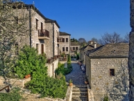
oikismos
The waterfalls in Iliochori, Iliohori, Κεντρικό Ζαγόρι, Βλαχοχώρια,.
80 Ελλάδα, Iliohori, , Κεντρικό Ζαγόρι, Βλαχοχώρια,, Zagorochoria,
marker-id-80
https://map-greece.com/en/epirus/template/el/images/markers/axiotheatalimni-def.png
Ελλάδα, Νομός EN: Ioannina, Zagorochoria, Iliohori, , Κεντρικό Ζαγόρι, Βλαχοχώρια,,
39.9767236
20.9234765
axiotheata
The waterfalls in Iliochori, Iliohori, Κεντρικό Ζαγόρι, Βλαχοχώρια,.
80 Ελλάδα, Iliohori, , Κεντρικό Ζαγόρι, Βλαχοχώρια,, Zagorochoria,
marker-id-80
https://map-greece.com/en/epirus/template/el/images/markers/axiotheatalimni-def.png
Ελλάδα, Νομός EN: Ioannina, Zagorochoria, Iliohori, , Κεντρικό Ζαγόρι, Βλαχοχώρια,,
39.9767236
20.9234765
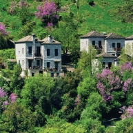
diamoni
The waterfalls in Iliochori, Iliohori, Κεντρικό Ζαγόρι, Βλαχοχώρια,.
80 Ελλάδα, Iliohori, , Κεντρικό Ζαγόρι, Βλαχοχώρια,, Zagorochoria,
marker-id-80
https://map-greece.com/en/epirus/template/el/images/markers/axiotheatalimni-def.png
Ελλάδα, Νομός EN: Ioannina, Zagorochoria, Iliohori, , Κεντρικό Ζαγόρι, Βλαχοχώρια,,
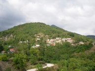
39.8069352
21.0045436
oikismos
Greveniti, Greveniti, Ανατολικό Ζαγόρι, Κοιλάδα του Βάρδα, Zagorochoria, , 1, Greece.
5 Ελλάδα, Greveniti, , Ανατολικό Ζαγόρι, Κοιλάδα του Βάρδα, Zagorochoria, Greece
marker-id-5
template/el/images/markers/oikismos.png
Greece, , Zagorochoria, Greveniti, , Ανατολικό Ζαγόρι, Κοιλάδα του Βάρδα,
39.8814634
20.7065317
oikismos
Ano Perdina Ano soudena, Ano Pedina, Κεντρικό Ζαγόρι, Κοιλάδα του Άνω Βίκου, Zagorochoria, Ioannina, 1, Greece.
1 Ελλάδα, Ano Pedina, , Κεντρικό Ζαγόρι, Κοιλάδα του Άνω Βίκου, Zagorochoria, Greece
marker-id-1
template/el/images/markers/oikismos.png
Greece, Ioannina, Zagorochoria, Ano Pedina, , Κεντρικό Ζαγόρι, Κοιλάδα του Άνω Βίκου,
39.5189074
21.1227921
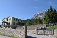
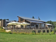
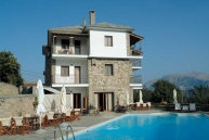
diamoni
Guesthouse Fteri Tzoumerka, Tsopelas, Τζουμέρκα, Tzoumerka, Ioannina, 4, Greece.
91 Ελλάδα, Tsopelas, 26590-62030, Τζουμέρκα, Tzoumerka, Greece
marker-id-91
template/el/images/markers/diamoni.png
Greece, Ioannina, Tzoumerka, Tsopelas, , Τζουμέρκα,
39.7702982
21.1829426
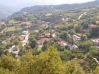
oikismos
, Metsovo, Μέτσοβο, Metsovo, Ioannina, 1, Greece.
76 Ελλάδα, Metsovo, , Μέτσοβο, Metsovo, Greece
marker-id-76
template/el/images/markers/oikismos.png
Greece, Ioannina, Metsovo, Metsovo, 442 00, Μέτσοβο,
39.5944192
21.1076724
oikismos
Syrrako, Syrrako, Τζουμέρκα, Tzoumerka, Ioannina, 1, Greece.
83 Ελλάδα, Syrrako, , Τζουμέρκα, Tzoumerka, Greece
marker-id-83
template/el/images/markers/oikismos.png
Greece, Ioannina, Tzoumerka, Syrrako, , Τζουμέρκα,
39.6680078
20.8559651
diamoni
Hotel Metropolis, Ioannina, Ιωάννινα,, Ioannina, Ioannina, 4, Greece.
53 Ελλάδα, Ioannina, 26510 30004, Ιωάννινα,, Ioannina, Greece
marker-id-53
template/el/images/markers/diamoni.png
Greece, Ioannina, Ioannina, Ioannina, 45444, Ιωάννινα,,
39.8825773
20.7456195
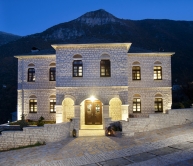
diamoni
Zagori Philoxenia Hotel, Monodendri, Κεντρικό Ζαγόρι,, Zagorochoria, Ioannina, 4, Greece.
57 Ελλάδα, Monodendri, 26530 71040, Κεντρικό Ζαγόρι,, Zagorochoria, Greece
marker-id-57
template/el/images/markers/diamoni.png
Greece, Ioannina, Zagorochoria, Monodendri, 44007, Κεντρικό Ζαγόρι,,
39.5181543
21.1207644
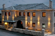
diamoni
Tzoumerka Horizons Hotel Resort, Pramanta, Τζουμέρκα, Tzoumerka, Ioannina, 4, Greece.
90 Ελλάδα, Pramanta, 26590 61002, Τζουμέρκα, Tzoumerka, Greece
marker-id-90
template/el/images/markers/diamoni.png
Greece, Ioannina, Tzoumerka, Pramanta, , Τζουμέρκα,
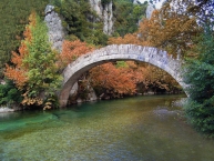
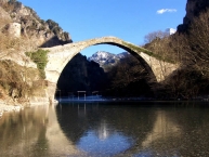
39.9676710
20.6633773
axiotheata
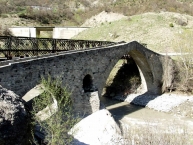
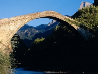
Το γεφύρι του Βοϊδομάτη, Kleidonia, Δυτικό Ζαγόρι,, Konitsa, Ioannina, 3, Greece.
61 Ελλάδα, Kleidonia, , Δυτικό Ζαγόρι,, Konitsa, Greece
marker-id-61
template/el/images/markers/axiotheatagefyra.png
Greece, Ioannina, Konitsa, Kleidonia, , Δυτικό Ζαγόρι,,
39.7659483
20.8655171
oikismos
Anthrakitis, Anthrakitis, Ανατολικό Ζαγόρι, Κοιλάδα του Ζαγορίτικου,, Zagorochoria, , 1, Greece.
10 Ελλάδα, Anthrakitis, , Ανατολικό Ζαγόρι, Κοιλάδα του Ζαγορίτικου,, Zagorochoria, Greece
marker-id-10
template/el/images/markers/oikismos.png
Greece, , Zagorochoria, Anthrakitis, , Ανατολικό Ζαγόρι, Κοιλάδα του Ζαγορίτικου,,
39.7724162
21.0275713
oikismos
Petra, Petra, Ανατολικό Ζαγόρι,, Zagorochoria, , 1, Greece.
16 Ελλάδα, Petra, , Ανατολικό Ζαγόρι,, Zagorochoria, Greece
marker-id-16
template/el/images/markers/oikismos.png
Greece, , Zagorochoria, Petra, , Ανατολικό Ζαγόρι,,
39.9490849
20.6842379
axiotheata
Μονή Παναγίας Σπηλιώτισσας, Aristi, Δυτικό Ζαγόρι, Κοιλάδα του Βοϊδομάτη,, Zagorochoria, Ioannina, 3, Greece.
69 Ελλάδα, Aristi, , Δυτικό Ζαγόρι, Κοιλάδα του Βοϊδομάτη,, Zagorochoria, Greece
marker-id-69
template/el/images/markers/axiotheatamoni.png
Greece, Ioannina, Zagorochoria, Aristi, , Δυτικό Ζαγόρι, Κοιλάδα του Βοϊδομάτη,,
39.9336104
20.6714188
diamoni
Αρτσίστας Οικίες ξενώνες σουίτες, Aristi, Δυτικό Ζαγόρι, Κοιλάδα του Βοϊδομάτη,, Zagorochoria, Ioannina, 4, Greece.
56 Ελλάδα, Aristi, 26530 41908, Δυτικό Ζαγόρι, Κοιλάδα του Βοϊδομάτη,, Zagorochoria, Greece
marker-id-56
template/el/images/markers/diamoni.png
Greece, Ioannina, Zagorochoria, Aristi, 44004, Δυτικό Ζαγόρι, Κοιλάδα του Βοϊδομάτη,,
39.3710628
21.1837258
oikismos
Voulgareli, Voulgareli, Τζουμέρκα, Tzoumerka, Arta, 1, Greece.
86 Ελλάδα, Voulgareli, , Τζουμέρκα, Tzoumerka, Greece
marker-id-86
template/el/images/markers/oikismos.png
Greece, Arta, Tzoumerka, Voulgareli, , Τζουμέρκα,
39.994137
20.786561
axiotheata
Δρακόλιμνη Γκαμήλας, Mikro Papigo, Δυτικό Ζαγόρι,, Zagorochoria, Ioannina, 3, Greece.
63 Ελλάδα, Mikro Papigo, , Δυτικό Ζαγόρι,, Zagorochoria, Greece
marker-id-63
template/el/images/markers/axiotheatalimni.png
Greece, Ioannina, Zagorochoria, Mikro Papigo, , Δυτικό Ζαγόρι,,
39.7427842
20.9141562
oikismos
Kavalari, Kavalari, Ανατολικό Ζαγόρι, Κοιλάδα του Ζαγορίτικου,, Zagorochoria, , 1, Greece.
13 Ελλάδα, Kavalari, , Ανατολικό Ζαγόρι, Κοιλάδα του Ζαγορίτικου,, Zagorochoria, Greece
marker-id-13
template/el/images/markers/oikismos.png
Greece, , Zagorochoria, Kavalari, , Ανατολικό Ζαγόρι, Κοιλάδα του Ζαγορίτικου,,
39.9348537
20.6726630
diamoni
Gamila Rocks Mountain Hotel, Aristi, Δυτικό Ζαγόρι, Κοιλάδα του Βοϊδομάτη,, Zagorochoria, Ioannina, 4, Greece.
52 Ελλάδα, Aristi, 26530 41070, Δυτικό Ζαγόρι, Κοιλάδα του Βοϊδομάτη,, Zagorochoria, Greece
marker-id-52
template/el/images/markers/diamoni.png
Greece, Ioannina, Zagorochoria, Aristi, 44016, Δυτικό Ζαγόρι, Κοιλάδα του Βοϊδομάτη,,
39.9399893
20.6410017
oikismos
Μεσοβούνι, Mesovouni, Δυτικό Ζαγόρι, Κοιλάδα του Βοϊδομάτη,, Zagorochoria, , 1, Greece.
46 Ελλάδα, Mesovouni, , Δυτικό Ζαγόρι, Κοιλάδα του Βοϊδομάτη,, Zagorochoria, Greece
marker-id-46
template/el/images/markers/oikismos.png
Greece, , Zagorochoria, Mesovouni, , Δυτικό Ζαγόρι, Κοιλάδα του Βοϊδομάτη,,
39.8236368
20.7283764
oikismos
Asprageloi, Asprageloi, Κεντρικό Ζαγόρι,, Zagorochoria, , 1, Greece.
26 Ελλάδα, Asprageloi, , Κεντρικό Ζαγόρι,, Zagorochoria, Greece
marker-id-26
template/el/images/markers/oikismos.png
Greece, , Zagorochoria, Asprageloi, , Κεντρικό Ζαγόρι,,
39.8803977
20.7070329
diamoni
Amaryllis Luxury Guest House, Ano Pedina, Κεντρικό Ζαγόρι, Κοιλάδα του Άνω Βίκου,, Zagorochoria, Ioannina, 4, Greece.
49 Ελλάδα, Ano Pedina, 26530 71132, Κεντρικό Ζαγόρι, Κοιλάδα του Άνω Βίκου,, Zagorochoria, Greece
marker-id-49
template/el/images/markers/diamoni.png
Greece, Ioannina, Zagorochoria, Ano Pedina, 44007, Κεντρικό Ζαγόρι, Κοιλάδα του Άνω Βίκου,,
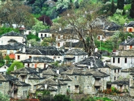
39.8879955
20.7797559
oikismos
Kapesovo, Kapesovo, Κεντρικό Ζαγόρι,, Zagorochoria, , 1, Greece.
28 Ελλάδα, Kapesovo, , Κεντρικό Ζαγόρι,, Zagorochoria, Greece
marker-id-28
template/el/images/markers/oikismos.png
Greece, , Zagorochoria, Kapesovo, , Κεντρικό Ζαγόρι,,
39.8738005
20.7481944
diamoni
Zagori Suites Hotel, Vitsa, Κεντρικό Ζαγόρι,, Zagorochoria, Ioannina, 4, Greece.
55 Ελλάδα, Vitsa, 26530.71076, Κεντρικό Ζαγόρι,, Zagorochoria, Greece
marker-id-55
template/el/images/markers/diamoni.png
Greece, Ioannina, Zagorochoria, Vitsa, , Κεντρικό Ζαγόρι,,
39.9458505
20.6976885
axiotheata
Πηγές του Βοϊδομάτη, Vikos, Δυτικό Ζαγόρι, Κοιλάδα του Βοϊδομάτη,, Zagorochoria, Ioannina, 3, Greece.
71 Ελλάδα, Vikos, , Δυτικό Ζαγόρι, Κοιλάδα του Βοϊδομάτη,, Zagorochoria, Greece
marker-id-71
template/el/images/markers/axiotheatalimni.png
Greece, Ioannina, Zagorochoria, Vikos, , Δυτικό Ζαγόρι, Κοιλάδα του Βοϊδομάτη,,
39.8736883
20.7500929
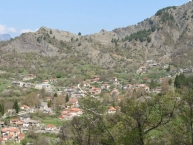
oikismos
Vitsa, Vitsa, Κεντρικό Ζαγόρι,, Zagorochoria, , 1, Greece.
20 Ελλάδα, Vitsa, , Κεντρικό Ζαγόρι,, Zagorochoria, Greece
marker-id-20
template/el/images/markers/oikismos.png
Greece, , Zagorochoria, Vitsa, , Κεντρικό Ζαγόρι,,
39.9521298
20.7074347
oikismos
Vikos, Vikos, Δυτικό Ζαγόρι, Κοιλάδα του Βοϊδομάτη,, Zagorochoria, Ioannina, 1, Greece.
44 Ελλάδα, Vikos, , Δυτικό Ζαγόρι, Κοιλάδα του Βοϊδομάτη,, Zagorochoria, Greece
marker-id-44
template/el/images/markers/oikismos.png
Greece, Ioannina, Zagorochoria, Vikos, , Δυτικό Ζαγόρι, Κοιλάδα του Βοϊδομάτη,,
39.5235560
21.1239340
oikismos
Tsopelas, Tsopelas, Τζουμέρκα, Tzoumerka, Ioannina, 1, Greece.
82 Ελλάδα, Tsopelas, , Τζουμέρκα, Tzoumerka, Greece
marker-id-82
template/el/images/markers/oikismos.png
Greece, Ioannina, Tzoumerka, Tsopelas, , Τζουμέρκα,
39.8531158
20.7650051
diamoni
Αρχοντικό του Διλόφου, Dilofo, Κεντρικό Ζαγόρι,, Zagorochoria, Ioannina, 4, Greece.
60 Ελλάδα, Dilofo, 26530 22455, Κεντρικό Ζαγόρι,, Zagorochoria, Greece
marker-id-60
template/el/images/markers/diamoni.png
Greece, Ioannina, Zagorochoria, Dilofo, 45070, Κεντρικό Ζαγόρι,,
39.8264189
20.7482825
oikismos
Ελάτη, Elati, Κεντρικό Ζαγόρι, Κοιλάδα του Άνω Βίκου,, Zagorochoria, , 1, Greece.
33 Ελλάδα, Elati, , Κεντρικό Ζαγόρι, Κοιλάδα του Άνω Βίκου,, Zagorochoria, Greece
marker-id-33
template/el/images/markers/oikismos.png
Greece, , Zagorochoria, Elati, , Κεντρικό Ζαγόρι, Κοιλάδα του Άνω Βίκου,,
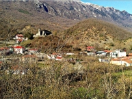
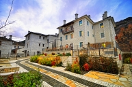
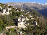
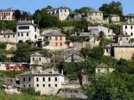
39.9767236
20.9234765
axiotheata
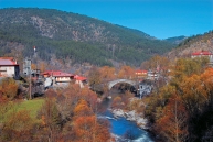
The waterfalls in Iliochori, Iliohori, Κεντρικό Ζαγόρι, Βλαχοχώρια,, Zagorochoria, Ioannina, 3, Greece.
80 Ελλάδα, Iliohori, , Κεντρικό Ζαγόρι, Βλαχοχώρια,, Zagorochoria, Greece
marker-id-80
template/el/images/markers/axiotheatalimni.png
Greece, Ioannina, Zagorochoria, Iliohori, , Κεντρικό Ζαγόρι, Βλαχοχώρια,,
39.9725706
20.9540277
oikismos
Laista, Laista, Κεντρικό Ζαγόρι, Βλαχοχώρια,, Zagorochoria, , 1, Greece.
23 Ελλάδα, Laista, , Κεντρικό Ζαγόρι, Βλαχοχώρια,, Zagorochoria, Greece
marker-id-23
template/el/images/markers/oikismos.png
Greece, , Zagorochoria, Laista, , Κεντρικό Ζαγόρι, Βλαχοχώρια,,
39.7534453
21.0187413
oikismos
Agia Paraskevi, Agia Paraskevi, Ανατολικό Ζαγόρι,, Zagorochoria, , 1, Greece.
18 Ελλάδα, Agia Paraskevi, , Ανατολικό Ζαγόρι,, Zagorochoria, Greece
marker-id-18
template/el/images/markers/oikismos.png
Greece, , Zagorochoria, Agia Paraskevi, , Ανατολικό Ζαγόρι,,
39.8970862
20.7770544
oikismos
Βραδέτο, Vradeto, Κεντρικό Ζαγόρι, Κοιλάδα του Άνω Βίκου,, Zagorochoria, , 1, Greece.
32 Ελλάδα, Vradeto, , Κεντρικό Ζαγόρι, Κοιλάδα του Άνω Βίκου,, Zagorochoria, Greece
marker-id-32
template/el/images/markers/oikismos.png
Greece, , Zagorochoria, Vradeto, , Κεντρικό Ζαγόρι, Κοιλάδα του Άνω Βίκου,,
39.9687742
20.7295361
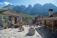
oikismos
Μικρό Πάπιγκο, Mikro Papigo, Δυτικό Ζαγόρι, Κοιλάδα του Βοϊδομάτη,, Zagorochoria, , 1, Greece.
43 Ελλάδα, Mikro Papigo, , Δυτικό Ζαγόρι, Κοιλάδα του Βοϊδομάτη,, Zagorochoria, Greece
marker-id-43
template/el/images/markers/oikismos.png
Greece, , Zagorochoria, Mikro Papigo, , Δυτικό Ζαγόρι, Κοιλάδα του Βοϊδομάτη,,
39.9675939
20.7199128
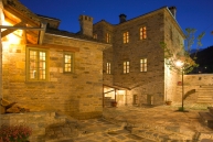
diamoni
Astra Inn Ξενώνας, Megalo Papigo, Δυτικό Ζαγόρι, Κοιλάδα του Βοϊδομάτη,, Zagorochoria, Ioannina, 4, Greece.
51 Ελλάδα, Megalo Papigo, 26530 42108, Δυτικό Ζαγόρι, Κοιλάδα του Βοϊδομάτη,, Zagorochoria, Greece
marker-id-51
template/el/images/markers/diamoni.png
Greece, Ioannina, Zagorochoria, Megalo Papigo, 44004, Δυτικό Ζαγόρι, Κοιλάδα του Βοϊδομάτη,,
40.228465
20.914278
axiotheata
, Konitsa, Κόνιτσα, Konitsa, Ioannina, 3, Greece.
78 Ελλάδα, Konitsa, , Κόνιτσα, Konitsa, Greece
marker-id-78
template/el/images/markers/axiotheatagefyra.png
Greece, Ioannina, Konitsa, Konitsa, , Κόνιτσα,
39.5080510
21.1475853
oikismos
Melissourgoi, Melissourgoi, Τζουμέρκα, Tzoumerka, Arta, 1, Greece.
85 Ελλάδα, Melissourgoi, , Τζουμέρκα, Tzoumerka, Greece
marker-id-85
template/el/images/markers/oikismos.png
Greece, Arta, Tzoumerka, Melissourgoi, , Τζουμέρκα,
39.8642073
20.7923650
oikismos
Khpoi, Kipi, Κεντρικό Ζαγόρι,, Zagorochoria, , 1, Greece.
24 Ελλάδα, Kipi, , Κεντρικό Ζαγόρι,, Zagorochoria, Greece
marker-id-24
template/el/images/markers/oikismos.png
Greece, , Zagorochoria, Kipi, , Κεντρικό Ζαγόρι,,
39.572739
21.083745
diamoni
Hotel Lakmos, Syrrako, , Tzoumerka, Ioannina, 4, Greece.
94 Ελλάδα, Syrrako, 2651053444, , Tzoumerka, Greece
marker-id-94
template/el/images/markers/diamoni.png
Greece, Ioannina, Tzoumerka, Syrrako, 440 01, ,
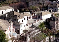
39.9801237
20.9102440
oikismos
Iliohori Ntobrinovo, Iliohori, Κεντρικό Ζαγόρι, Βλαχοχώρια,, Zagorochoria, , 1, Greece.
22 Ελλάδα, Iliohori, , Κεντρικό Ζαγόρι, Βλαχοχώρια,, Zagorochoria, Greece
marker-id-22
template/el/images/markers/oikismos.png
Greece, , Zagorochoria, Iliohori, , Κεντρικό Ζαγόρι, Βλαχοχώρια,,
39.9380336
21.0488912
oikismos
Vovousa, Vovousa, Ανατολικό Ζαγόρι,, Zagorochoria, , 1, Greece.
3 Ελλάδα, Vovousa, , Ανατολικό Ζαγόρι,, Zagorochoria, Greece
marker-id-3
template/el/images/markers/oikismos.png
Greece, , Zagorochoria, Vovousa, , Ανατολικό Ζαγόρι,,
39.8632738
20.8470910
oikismos
Negades, Negades, Κεντρικό Ζαγόρι,, Zagorochoria, Ioannina, 1, Greece.
31 Ελλάδα, Negades, , Κεντρικό Ζαγόρι,, Zagorochoria, Greece
marker-id-31
template/el/images/markers/oikismos.png
Greece, Ioannina, Zagorochoria, Negades, , Κεντρικό Ζαγόρι,,
39.9477542
20.6708708
oikismos
Άγιος Μηνάς, Agios Minas, Δυτικό Ζαγόρι, Κοιλάδα του Βοϊδομάτη,, Zagorochoria, , 1, Greece.
45 Ελλάδα, Agios Minas, , Δυτικό Ζαγόρι, Κοιλάδα του Βοϊδομάτη,, Zagorochoria, Greece
marker-id-45
template/el/images/markers/oikismos.png
Greece, , Zagorochoria, Agios Minas, , Δυτικό Ζαγόρι, Κοιλάδα του Βοϊδομάτη,,
39.8817623
20.7061266
diamoni
Ξενώνας Πρίμουλα, Ano Pedina, Κεντρικό Ζαγόρι, Κοιλάδα του Άνω Βίκου,, Zagorochoria, Ioannina, 4, Greece.
59 Ελλάδα, Ano Pedina, 26530 71133, Κεντρικό Ζαγόρι, Κοιλάδα του Άνω Βίκου,, Zagorochoria, Greece
marker-id-59
template/el/images/markers/diamoni.png
Greece, Ioannina, Zagorochoria, Ano Pedina, 44007, Κεντρικό Ζαγόρι, Κοιλάδα του Άνω Βίκου,,
39.5228608
21.1045363
oikismos
Pramanta, Pramanta, Τζουμέρκα, Tzoumerka, Ioannina, 1, Greece.
81 Ελλάδα, Pramanta, , Τζουμέρκα, Tzoumerka, Greece
marker-id-81
template/el/images/markers/oikismos.png
Greece, Ioannina, Tzoumerka, Pramanta, , Τζουμέρκα,
39.8298339
20.8842353
oikismos
Φραγκάδες, Fragades, Κεντρικό Ζαγόρι,, Zagorochoria, , 1, Greece.
40 Ελλάδα, Fragades, , Κεντρικό Ζαγόρι,, Zagorochoria, Greece
marker-id-40
template/el/images/markers/oikismos.png
Greece, , Zagorochoria, Fragades, , Κεντρικό Ζαγόρι,,
39.8776501
20.7055601
axiotheata
Μονή Ευαγγελίστριας, Ano Pedina, Κεντρικό Ζαγόρι, Κοιλάδα του Άνω Βίκου,, Zagorochoria, Ioannina, 3, Greece.
72 Ελλάδα, Ano Pedina, , Κεντρικό Ζαγόρι, Κοιλάδα του Άνω Βίκου,, Zagorochoria, Greece
marker-id-72
template/el/images/markers/axiotheatamoni.png
Greece, Ioannina, Zagorochoria, Ano Pedina, , Κεντρικό Ζαγόρι, Κοιλάδα του Άνω Βίκου,,
39.9050285
20.8208752
oikismos
Tsepelovo, Tsepelovo, Κεντρικό Ζαγόρι,, Zagorochoria, , 1, Greece.
29 Ελλάδα, Tsepelovo, , Κεντρικό Ζαγόρι,, Zagorochoria, Greece
marker-id-29
template/el/images/markers/oikismos.png
Greece, , Zagorochoria, Tsepelovo, , Κεντρικό Ζαγόρι,,
39.7331499
21.0226130
oikismos
Demati, Demati, Ανατολικό Ζαγόρι,, Zagorochoria, , 1, Greece.
14 Ελλάδα, Demati, , Ανατολικό Ζαγόρι,, Zagorochoria, Greece
marker-id-14
template/el/images/markers/oikismos.png
Greece, , Zagorochoria, Demati, , Ανατολικό Ζαγόρι,,
39.7900536
20.8752396
oikismos
Διπόταμο, Dipotamo, Κεντρικό Ζαγόρι,, Zagorochoria, , 1, Greece.
39 Ελλάδα, Dipotamo, , Κεντρικό Ζαγόρι,, Zagorochoria, Greece
marker-id-39
template/el/images/markers/oikismos.png
Greece, , Zagorochoria, Dipotamo, , Κεντρικό Ζαγόρι,,
39.8717730
20.7756358
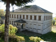
axiotheata
Λαογραφικό μουσείο Λαζαρίδη, Koukouli, Κεντρικό Ζαγόρι,, Zagorochoria, Ioannina, 3, Greece.
66 Ελλάδα, Koukouli, 26530 71775, Κεντρικό Ζαγόρι,, Zagorochoria, Greece
marker-id-66
template/el/images/markers/axiotheata.png
Greece, Ioannina, Zagorochoria, Koukouli, , Κεντρικό Ζαγόρι,,
39.5555082
20.8735056
axiotheata
Μουσείο κέρινων ομοιωμάτων Ελληνικής Ιστορίας Παύλου Βρέλλη, Ioannina, Ιωάννινα, Ioannina, Ioannina, 3, Greece.
73 Ελλάδα, Ioannina, 2651 092128, Ιωάννινα, Ioannina, Greece
marker-id-73
template/el/images/markers/axiotheatamousio.png
Greece, Ioannina, Ioannina, Ioannina, 455 00, Ιωάννινα,
39.5837369
21.1238515
oikismos
Kalarrytes, Kalarrytes, Τζουμέρκα, Tzoumerka, Ioannina, 1, Greece.
84 Ελλάδα, Kalarrytes, , Τζουμέρκα, Tzoumerka, Greece
marker-id-84
template/el/images/markers/oikismos.png
Greece, Ioannina, Tzoumerka, Kalarrytes, , Τζουμέρκα,
39.9008329
20.6893115
oikismos
Ελαφότοπος, Elafotopos, Κεντρικό Ζαγόρι, Κοιλάδα του Άνω Βίκου, Zagorochoria, , 1, Greece.
34 Ελλάδα, Elafotopos, , Κεντρικό Ζαγόρι, Κοιλάδα του Άνω Βίκου, Zagorochoria, Greece
marker-id-34
template/el/images/markers/oikismos.png
Greece, , Zagorochoria, Elafotopos, , Κεντρικό Ζαγόρι, Κοιλάδα του Άνω Βίκου,
39.8229278
20.9518641
oikismos
Doliani, Doliani, Ανατολικό Ζαγόρι, Κοιλάδα του Ζαγορίτικου,, Zagorochoria, , 1, Greece.
12 Ελλάδα, Doliani, , Ανατολικό Ζαγόρι, Κοιλάδα του Ζαγορίτικου,, Zagorochoria, Greece
marker-id-12
template/el/images/markers/oikismos.png
Greece, , Zagorochoria, Doliani, , Ανατολικό Ζαγόρι, Κοιλάδα του Ζαγορίτικου,,
39.8478116
20.9544848
oikismos
Kastanonas Dragari, Kastanonas, Ανατολικό Ζαγόρι,, Zagorochoria, , 1, Greece.
17 Ελλάδα, Kastanonas, , Ανατολικό Ζαγόρι,, Zagorochoria, Greece
marker-id-17
template/el/images/markers/oikismos.png
Greece, , Zagorochoria, Kastanonas, , Ανατολικό Ζαγόρι,,
39.9115914
20.8488311
oikismos
Skamneli, Skamneli, Κεντρικό Ζαγόρι,, Zagorochoria, , 1, Greece.
30 Ελλάδα, Skamneli, , Κεντρικό Ζαγόρι,, Zagorochoria, Greece
marker-id-30
template/el/images/markers/oikismos.png
Greece, , Zagorochoria, Skamneli, , Κεντρικό Ζαγόρι,,
39.8706980
20.7739555
oikismos
Koukouli, Koukouli, Κεντρικό Ζαγόρι, Zagorochoria, , 1, Greece.
27 Ελλάδα, Koukouli, , Κεντρικό Ζαγόρι, Zagorochoria, Greece
marker-id-27
template/el/images/markers/oikismos.png
Greece, , Zagorochoria, Koukouli, , Κεντρικό Ζαγόρι,
39.8715218
20.9798244
oikismos
Elatohori, Elatohori, Ανατολικό Ζαγόρι, Κοιλάδα του Βάρδα, Zagorochoria, , 1, Greece.
6 Ελλάδα, Elatohori, , Ανατολικό Ζαγόρι, Κοιλάδα του Βάρδα, Zagorochoria, Greece
marker-id-6
template/el/images/markers/oikismos.png
Greece, , Zagorochoria, Elatohori, , Ανατολικό Ζαγόρι, Κοιλάδα του Βάρδα,
39.8873132
20.7804664
axiotheata
Πασχάλειος Σχολή Καπεσόβου, Kapesovo, Κεντρικό Ζαγόρι,, Zagorochoria, Ioannina, 3, Greece.
68 Ελλάδα, Kapesovo, , Κεντρικό Ζαγόρι,, Zagorochoria, Greece
marker-id-68
template/el/images/markers/axiotheatamousio.png
Greece, Ioannina, Zagorochoria, Kapesovo, , Κεντρικό Ζαγόρι,,
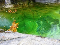
39.9735500
20.7256796
axiotheata
Papingo Rock Pools, Mikro Papigo, Δυτικό Ζαγόρι, Κοιλάδα του Βοϊδομάτη,, Zagorochoria, Ioannina, 3, Greece.
65 Ελλάδα, Mikro Papigo, , Δυτικό Ζαγόρι, Κοιλάδα του Βοϊδομάτη,, Zagorochoria, Greece
marker-id-65
template/el/images/markers/axiotheatalimni.png
Greece, Ioannina, Zagorochoria, Mikro Papigo, , Δυτικό Ζαγόρι, Κοιλάδα του Βοϊδομάτη,,
39.8943205
20.7857555
axiotheata
Σκάλα Βραδέτου, Vradeto, Κεντρικό Ζαγόρι, Κοιλάδα του Άνω Βίκου,, Zagorochoria, Ioannina, 3, Greece.
67 Ελλάδα, Vradeto, , Κεντρικό Ζαγόρι, Κοιλάδα του Άνω Βίκου,, Zagorochoria, Greece
marker-id-67
template/el/images/markers/axiotheata.png
Greece, Ioannina, Zagorochoria, Vradeto, , Κεντρικό Ζαγόρι, Κοιλάδα του Άνω Βίκου,,
39.7937798
21.0016682
oikismos
Tristeno, Tristeno, Ανατολικό Ζαγόρι, Κοιλάδα του Βάρδα,, Zagorochoria, , 1, Greece.
9 Ελλάδα, Tristeno, , Ανατολικό Ζαγόρι, Κοιλάδα του Βάρδα,, Zagorochoria, Greece
marker-id-9
template/el/images/markers/oikismos.png
Greece, , Zagorochoria, Tristeno, , Ανατολικό Ζαγόρι, Κοιλάδα του Βάρδα,,
40.036439
20.745175
axiotheata
, Konitsa, Κόνιτσα, Konitsa, Ioannina, 3, Greece.
79 Ελλάδα, Konitsa, , Κόνιτσα, Konitsa, Greece
marker-id-79
template/el/images/markers/axiotheatagefyra.png
Greece, Ioannina, Konitsa, Konitsa, , Κόνιτσα,
39.8547220
20.9908106
oikismos
Flampourari, Flampourari, Ανατολικό Ζαγόρι, Κοιλάδα του Βάρδα, Zagorochoria, , 1, Greece.
8 Ελλάδα, Flampourari, , Ανατολικό Ζαγόρι, Κοιλάδα του Βάρδα, Zagorochoria, Greece
marker-id-8
template/el/images/markers/oikismos.png
Greece, , Zagorochoria, Flampourari, , Ανατολικό Ζαγόρι, Κοιλάδα του Βάρδα,
39.4355228
21.2099282
oikismos
Theodoriana, Theodoriana, Τζουμέρκα, Tzoumerka, Arta, 1, Greece.
88 Ελλάδα, Theodoriana, , Τζουμέρκα, Tzoumerka, Greece
marker-id-88
template/el/images/markers/oikismos.png
Greece, Arta, Tzoumerka, Theodoriana, , Τζουμέρκα,
39.8661837
20.7924723
diamoni
Aria Hotels Kipi Suites, Kipi, Κεντρικό Ζαγόρι,, Zagorochoria, Ioannina, 4, Greece.
54 Ελλάδα, Kipi, 26530 71995, Κεντρικό Ζαγόρι,, Zagorochoria, Greece
marker-id-54
template/el/images/markers/diamoni.png
Greece, Ioannina, Zagorochoria, Kipi, 44010, Κεντρικό Ζαγόρι,,
39.8795302
20.6751998
oikismos
Kato Pedina, Kato Pedina, Κεντρικό Ζαγόρι, Κοιλάδα του Άνω Βίκου,, Zagorochoria, Ioannina, 1, Greece.
35 Ελλάδα, Kato Pedina, , Κεντρικό Ζαγόρι, Κοιλάδα του Άνω Βίκου,, Zagorochoria, Greece
marker-id-35
template/el/images/markers/oikismos.png
Greece, Ioannina, Zagorochoria, Kato Pedina, , Κεντρικό Ζαγόρι, Κοιλάδα του Άνω Βίκου,,
39.8812795
20.7487030
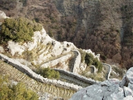
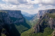
axiotheata
Vikos Gorge, Monodendri, Κεντρικό Ζαγόρι,, Zagorochoria, Ioannina, 3, Greece.
62 Ελλάδα, Monodendri, , Κεντρικό Ζαγόρι,, Zagorochoria, Greece
marker-id-62
template/el/images/markers/axiotheatafaragi.png
Greece, Ioannina, Zagorochoria, Monodendri, , Κεντρικό Ζαγόρι,,
39.7668769
21.0107320
oikismos
Itea, Itea, Ανατολικό Ζαγόρι,, Zagorochoria, , 1, Greece.
15 Ελλάδα, Itea, , Ανατολικό Ζαγόρι,, Zagorochoria, Greece
marker-id-15
template/el/images/markers/oikismos.png
Greece, , Zagorochoria, Itea, , Ανατολικό Ζαγόρι,,
39.9680835
20.7187214
oikismos
Μεγάλο Πάπιγκο, Megalo Papigo, Δυτικό Ζαγόρι, Κοιλάδα του Βοϊδομάτη,, Zagorochoria, , 1, Greece.
42 Ελλάδα, Megalo Papigo, , Δυτικό Ζαγόρι, Κοιλάδα του Βοϊδομάτη,, Zagorochoria, Greece
marker-id-42
template/el/images/markers/oikismos.png
Greece, , Zagorochoria, Megalo Papigo, , Δυτικό Ζαγόρι, Κοιλάδα του Βοϊδομάτη,,
39.7908451
20.8211234
oikismos
Manassi, Manassi, Κεντρικό Ζαγόρι,, Zagorochoria, , 1, Greece.
37 Ελλάδα, Manassi, , Κεντρικό Ζαγόρι,, Zagorochoria, Greece
marker-id-37
template/el/images/markers/oikismos.png
Greece, , Zagorochoria, Manassi, , Κεντρικό Ζαγόρι,,
39.7332189
20.9336147
oikismos
Karyes, Karyes, Ανατολικό Ζαγόρι, Κοιλάδα του Ζαγορίτικου,, Zagorochoria, , 1, Greece.
11 Ελλάδα, Karyes, , Ανατολικό Ζαγόρι, Κοιλάδα του Ζαγορίτικου,, Zagorochoria, Greece
marker-id-11
template/el/images/markers/oikismos.png
Greece, , Zagorochoria, Karyes, , Ανατολικό Ζαγόρι, Κοιλάδα του Ζαγορίτικου,,
39.9362368
20.6735804
diamoni
Aberratio Hotel Zagori, Aristi, Δυτικό Ζαγόρι, Κοιλάδα του Βοϊδομάτη, Zagorochoria, Ioannina, 4, Greece.
48 Ελλάδα, Aristi, 26530 42 202, Δυτικό Ζαγόρι, Κοιλάδα του Βοϊδομάτη, Zagorochoria, Greece
marker-id-48
template/el/images/markers/diamoni.png
Greece, Ioannina, Zagorochoria, Aristi, 44004, Δυτικό Ζαγόρι, Κοιλάδα του Βοϊδομάτη,
39.5245600
21.1250023
diamoni
Hotel Xenion Tzoumerka, Tsopelas, Τζουμέρκα, Tzoumerka, Ioannina, 4, Greece.
92 Ελλάδα, Tsopelas, 26590 62350, Τζουμέρκα, Tzoumerka, Greece
marker-id-92
template/el/images/markers/diamoni.png
Greece, Ioannina, Tzoumerka, Tsopelas, , Τζουμέρκα,
39.9335497
20.6698332
diamoni
Aristi Mountain Resort & Villas, Aristi, Δυτικό Ζαγόρι, Κοιλάδα του Βοϊδομάτη,, Zagorochoria, Ioannina, 4, Greece.
50 Ελλάδα, Aristi, 26530 41330, Δυτικό Ζαγόρι, Κοιλάδα του Βοϊδομάτη,, Zagorochoria, Greece
marker-id-50
template/el/images/markers/diamoni.png
Greece, Ioannina, Zagorochoria, Aristi, , Δυτικό Ζαγόρι, Κοιλάδα του Βοϊδομάτη,,
40.0482302
20.7530596
oikismos
, Konitsa, Κόνιτσα, Konitsa, Ioannina, 1, Greece.
77 Ελλάδα, Konitsa, , Κόνιτσα, Konitsa, Greece
marker-id-77
template/el/images/markers/oikismos.png
Greece, Ioannina, Konitsa, Konitsa, , Κόνιτσα,
39.8226489
20.9108428
oikismos
Λεπτοκαρυά, leptokarya, Κεντρικό Ζαγόρι ,, Zagorochoria, , 1, Greece.
41 Ελλάδα, leptokarya, , Κεντρικό Ζαγόρι ,, Zagorochoria, Greece
marker-id-41
template/el/images/markers/oikismos.png
Greece, , Zagorochoria, leptokarya, , Κεντρικό Ζαγόρι ,,
39.5213158
21.1195842
diamoni
Hotel Anavasi at Tzoumerka, Tsopelas, Τζουμέρκα, Tzoumerka, Ioannina, 4, Greece.
89 Ελλάδα, Tsopelas, 26590.61.138, Τζουμέρκα, Tzoumerka, Greece
marker-id-89
template/el/images/markers/diamoni.png
Greece, Ioannina, Tzoumerka, Tsopelas, , Τζουμέρκα,
39.7196149
20.9709616
oikismos
Potamia, Potamia, Ανατολικό Ζαγόρι,, Zagorochoria, , 1, Greece.
19 Ελλάδα, Potamia, , Ανατολικό Ζαγόρι,, Zagorochoria, Greece
marker-id-19
template/el/images/markers/oikismos.png
Greece, , Zagorochoria, Potamia, , Ανατολικό Ζαγόρι,,
39.9997202
20.8869839
oikismos
Vrisohori, Vrisohori, Κεντρικό Ζαγόρι, Βλαχοχώρια,, Zagorochoria, , 1, Greece.
21 Ελλάδα, Vrisohori, , Κεντρικό Ζαγόρι, Βλαχοχώρια,, Zagorochoria, Greece
marker-id-21
template/el/images/markers/oikismos.png
Greece, , Zagorochoria, Vrisohori, , Κεντρικό Ζαγόρι, Βλαχοχώρια,,
39.9345834
20.6724514
oikismos
Aristi, Aristi, Δυτικό Ζαγόρι, Κοιλάδα του Βοϊδομάτη,, Zagorochoria, , 1, Greece.
4 Ελλάδα, Aristi, , Δυτικό Ζαγόρι, Κοιλάδα του Βοϊδομάτη,, Zagorochoria, Greece
marker-id-4
template/el/images/markers/oikismos.png
Greece, , Zagorochoria, Aristi, , Δυτικό Ζαγόρι, Κοιλάδα του Βοϊδομάτη,,
39.8773514
20.7462361
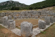
axiotheata
Αρχαίος οικισμός Μολοσσών Βίτσας, Vitsa, Κεντρικό Ζαγόρι,, Zagorochoria, Ioannina, 3, Greece.
64 Ελλάδα, Vitsa, , Κεντρικό Ζαγόρι,, Zagorochoria, Greece
marker-id-64
template/el/images/markers/axiotheataarxaia.png
Greece, Ioannina, Zagorochoria, Vitsa, , Κεντρικό Ζαγόρι,,
39.3749779
21.2165157
oikismos
Athamanio, Athamanio, Τζουμέρκα, Tzoumerka, Arta, 1, Greece.
87 Ελλάδα, Athamanio, , Τζουμέρκα, Tzoumerka, Greece
marker-id-87
template/el/images/markers/oikismos.png
Greece, Arta, Tzoumerka, Athamanio, , Τζουμέρκα,
39.8536879
20.7650321
oikismos
Dilofo, Dilofo, Κεντρικό Ζαγόρι,, Zagorochoria, , 1, Greece.
25 Ελλάδα, Dilofo, , Κεντρικό Ζαγόρι,, Zagorochoria, Greece
marker-id-25
template/el/images/markers/oikismos.png
Greece, , Zagorochoria, Dilofo, , Κεντρικό Ζαγόρι,,
39.8665152
20.9660914
oikismos
Makrino, Makrino, Ανατολικό Ζαγόρι, Κοιλάδα του Βάρδα, Zagorochoria, , 1, Greece.
7 Ελλάδα, Makrino, , Ανατολικό Ζαγόρι, Κοιλάδα του Βάρδα, Zagorochoria, Greece
marker-id-7
template/el/images/markers/oikismos.png
Greece, , Zagorochoria, Makrino, , Ανατολικό Ζαγόρι, Κοιλάδα του Βάρδα,
39.6949285
20.8463055
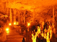
axiotheata
, Ioannina, Ιωάννινα,, Ioannina, Ioannina, 3, Greece.
74 Ελλάδα, Ioannina, 2651 081521, Ιωάννινα,, Ioannina, Greece
marker-id-74
template/el/images/markers/axiotheataspileo.png
Greece, Ioannina, Ioannina, Ioannina, 455 00, Ιωάννινα,,
39.8808547
20.7060781
diamoni
Pirrion Boutique Hotel, Ano Pedina, Κεντρικό Ζαγόρι, Κοιλάδα του Άνω Βίκου,, Zagorochoria, Ioannina, 4, Greece.
47 Ελλάδα, Ano Pedina, 26530 71141, Κεντρικό Ζαγόρι, Κοιλάδα του Άνω Βίκου,, Zagorochoria, Greece
marker-id-47
template/el/images/markers/diamoni.png
Greece, Ioannina, Zagorochoria, Ano Pedina, , Κεντρικό Ζαγόρι, Κοιλάδα του Άνω Βίκου,,
39.9709414
20.7199561
diamoni
Papaevangelou Hotel, Megalo Papigo, Δυτικό Ζαγόρι, Κοιλάδα του Βοϊδομάτη,, Zagorochoria, Ioannina, 4, Greece.
58 Ελλάδα, Megalo Papigo, 26530-41135, Δυτικό Ζαγόρι, Κοιλάδα του Βοϊδομάτη,, Zagorochoria, Greece
marker-id-58
template/el/images/markers/diamoni.png
Greece, Ioannina, Zagorochoria, Megalo Papigo, , Δυτικό Ζαγόρι, Κοιλάδα του Βοϊδομάτη,,
39.82201
20.9769881
axiotheata
Ιερά Μονή Βουτσάς Παναγιά η Πωγωνιώτισσα, Greveniti, Ανατολικό Ζαγόρι,, Zagorochoria, Ioannina, 3, Greece.
70 Ελλάδα, Greveniti, , Ανατολικό Ζαγόρι,, Zagorochoria, Greece
marker-id-70
template/el/images/markers/axiotheatamoni.png
Greece, Ioannina, Zagorochoria, Greveniti, , Ανατολικό Ζαγόρι,,
39.8824329
20.7478029
oikismos
Monodendri, Monodendri, Κεντρικό Ζαγόρι,, Zagorochoria, Ioannina, 1, Greece.
93 Ελλάδα, Monodendri, , Κεντρικό Ζαγόρι,, Zagorochoria, Greece
marker-id-93
template/el/images/markers/oikismos.png
Greece, Ioannina, Zagorochoria, Monodendri, , Κεντρικό Ζαγόρι,,
39.7824028
20.8356288
oikismos
Καλουτά, Kalouta, Κεντρικό Ζαγόρι,, Zagorochoria, , 1, Greece.
38 Ελλάδα, Kalouta, , Κεντρικό Ζαγόρι,, Zagorochoria, Greece
marker-id-38
template/el/images/markers/oikismos.png
Greece, , Zagorochoria, Kalouta, , Κεντρικό Ζαγόρι,,
39.7870198
20.7987216
oikismos
Δίκορφο, Dikorfo, Κεντρικό Ζαγόρι,, Zagorochoria, , 1, Greece.
36 Ελλάδα, Dikorfo, , Κεντρικό Ζαγόρι,, Zagorochoria, Greece
marker-id-36
template/el/images/markers/oikismos.png
Greece, , Zagorochoria, Dikorfo, , Κεντρικό Ζαγόρι,,
39.6655560
20.8538249
oikismos
Ιωάννινα, Ioannina, Ιωάννινα, Ioannina, , 1, Greece.
75 Ελλάδα, Ioannina, , Ιωάννινα, Ioannina, Greece
marker-id-75
template/el/images/markers/oikismos.png
Greece, , Ioannina, Ioannina, , Ιωάννινα,